
Covington ZIP Directory Coverage
Covington's city strategy identifies 41011, 41014, and 41015 as the primary postal areas. The broader official source set also contains a post-office-box code, nearby overlap routes, and a special-route lead. Those extra rows matter. Someone who searches only the three primary codes may miss a valid Covington mailing address, while someone who accepts every code carrying the word Covington may sweep in parcels from Bromley, Ludlow, or another nearby place. The Covington ZIP code directory therefore keeps primary and overlap codes in separate roles.
| ZIP Code | Areas Covered | Post Office | Notes |
|---|---|---|---|
| 41011 | Central, north, west, and older-city postal area | Covington Post Office | Primary code; verify each parcel |
| 41012 | Covington post office boxes | PO Box service | No street parcel can be found from this code alone |
| 41014 | Covington/Rouse; Peaselburg and southern-hillside clue | Confirm by exact address | Primary code with overlap concerns |
| 41015 | Latonia and southern Covington postal area | Latonia Station | Neighborhood and ZIP lines are not identical |
| 41016 | Covington/Bromley/Ludlow overlap | Route-dependent | Use only after parcel check |
| 41017 | Nearby Kenton area; some Covington mailing addresses | Ft. Mitchell-area description | Not every address is within Covington |
| 41019 | Institutional or unique-route lead | Special delivery | Not ordinary residential scope |
The official descriptions also place 41018 in the nearby Erlanger postal area and 41042 around Florence and Boone County. Neither belongs in an ordinary search for Covington residents unless an exact address or record establishes a city connection. Check current assignments because delivery areas can change. USPS remains the authority for postal formatting; Kenton parcel and municipal maps answer a different question.
Covington ZIP Postal Stations
The Covington Post Office is at 700 Scott Street and uses the 41011-9998 station code. The Latonia Station is at 111 E. Southern Avenue with 41015-9998. Those station codes identify USPS facilities, not residential blocks. They should not be copied into a resident result as though the final four digits describe a household.
The Covington ZIP code directory uses each station as a postal checkpoint. Search the exact street address through USPS, record the standardized city, state, ZIP, and ZIP+4, then return to the parcel system. A post office location confirms where mail services are based. It does not prove that every route served by that station falls within the incorporated city.
The official USPS ZIP lookup shows the three useful search modes.
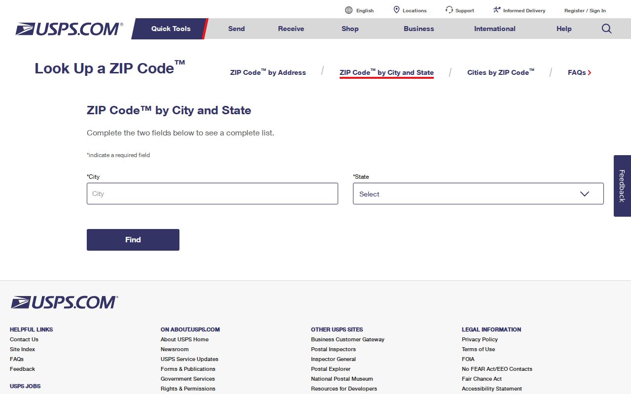
The form's separate address, city/state, and cities-by-ZIP paths help keep a full address check distinct from a broad postal-area search.
The Scott Street post office page confirms the main station.
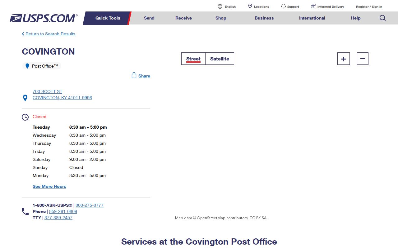
Station information anchors postal service, while parcel and city maps answer land and jurisdiction questions.
Covington ZIP Code 41015
ZIP 41015 is both a primary Covington code and a Latonia clue. Latonia is part of Covington's neighborhood context, but its postal reach does not create a legal neighborhood or city boundary. When an old directory, news item, or family record says Latonia, preserve that wording. Then compare its date and street with an official city or parcel layer.
This distinction is useful for genealogy. A historical record may use Latonia as the place name while a newer parcel card uses Covington. That difference is not, by itself, proof of a move. It may reflect the source's postal style, neighborhood usage, or the date of the record. Search both place labels, but join results only when the address and time period also agree.
The Latonia postal location record supplies the official station context.
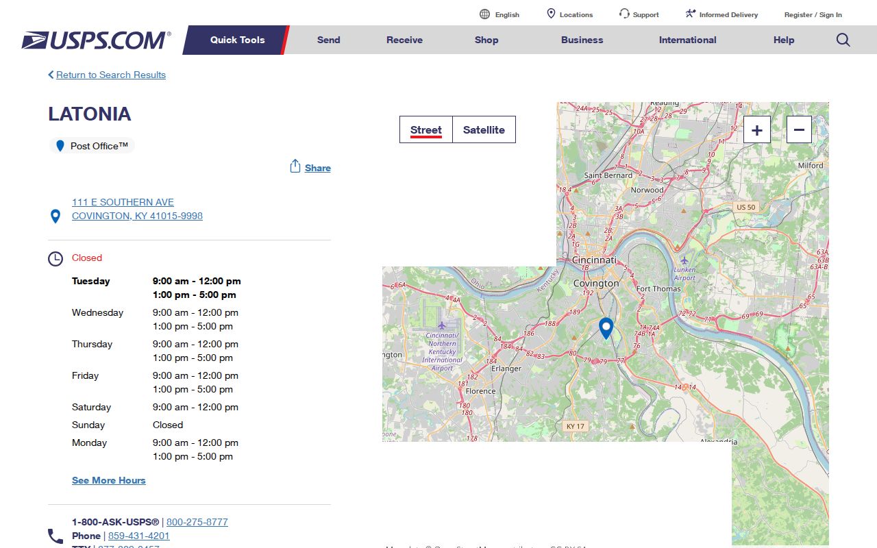
Use that station page as the postal source, then use Covington and Kenton maps for neighborhood and parcel facts.
Covington ZIP Lookup Fields
USPS exposes different fields for different questions. Kenton PVA does not show a simple ZIP filter, so a Covington ZIP code directory search cannot be pushed straight into the assessor form. The exact street address or PIDN, the parcel identification number, must bridge that gap.
| Search route | Fields | What it establishes |
|---|---|---|
| By address | Company, street, apartment, city, state, ZIP | Standard postal format and delivery code |
| By city/state | City, state | ZIP codes associated with that postal place |
| Cities by ZIP | ZIP | Postal city names associated with the code |
| Kenton PVA follow-up | Address number, street, PIDN, owner, deed, subdivision | Parcel and assessment context, not postal proof |
Save the date of each result. A postal output confirms neither a person nor a company at the address. Likewise, a PVA owner field is an assessment relationship and does not prove who is physically present.
Find Covington Residents by ZIP
Start broad only when the lawful source supports a ZIP field. Kentucky's SBE-84 voter-data request can offer ZIP ordering and residence or mailing ZIP fields to eligible requesters, subject to its certification, scope, fee, and use rules. The public Voter Information Center instead asks for a legal first name, legal last name, birth date, and optional last four digits of an SSN. It is not a ZIP-wide directory.
- Confirm the code through USPS. If a street address is known, use the full address mode instead of city/state alone.
- Check the exact parcel with Kenton PVA and GIS. PVA accepts an address or PIDN, not a basic ZIP filter.
- Use a ZIP-capable official source only for its stated purpose. Preserve eligibility, fee, and confidentiality rules.
- Confirm a name and role in a second dated record. ZIP data alone never establishes residence.
Once the postal area narrows to a named road, the Covington street directory gives the street-level workflow. That handoff avoids treating all households in one delivery zone as one neighborhood.
Covington ZIP 41012 Box Trap
41012 is a PO Box ZIP. It can identify a Covington mailing route, but it has no street parcel to map. A search that forces 41012 into the parcel system may return nothing or tempt the reader to attach a box to the wrong building. Keep the postal record separate until another official record supplies a street address.
Unique and institutional routes need the same care. ZIP 41019 appears as a special-route lead in the official postal material, not as an ordinary citywide residential code. Verify the delivery type before including it in any count or list.
Covington ZIP-Aware Record Systems
Several official systems contain a ZIP field, but each describes a different relationship. The Kentucky professional-license directory can filter a business location by city, state, or ZIP. The state offender registry supports ZIP and radius searches under its statutory purpose and misuse warning. Census ZCTAs support population analysis. None is a general roll of Covington residents.
The strongest method keeps each role label intact: postal destination, parcel owner, registered voter, licensed business location, or registry address. A match across two systems deserves review only when the name, address, date, and role align. Similar ZIP values alone are weak evidence.
Which ZIP source wins? USPS controls current mail formatting. Parcel GIS supports the city-limit question. Census controls ZCTA statistics. No single source replaces the other two.
Kentucky's professional-license search offers city, state, and ZIP fields for business locations. A license address describes the licensed branch or office, not a home. The Kentucky State Police registry also supports city, county, ZIP, map, and radius controls under its own statutory purpose and misuse warning. Those functions can answer tightly framed questions, but neither should be merged into a broad list of Covington residents. Preserve the portal name, result date, address role, and status shown by the agency.
The authorized SBE-84 voter-data route has a different design. Its form can request residence or mailing ZIP fields and alphabetical, street, or ZIP output, along with county, precinct, city, status, and other selected fields. Posted instructions describe eligibility and certification, a usual seven-to-ten-business-day process, and pricing that starts with a minimum charge in the captured material. Select only the fields needed and confirm the current form and cost before ordering. Safe at Home records require protected-address treatment.
Covington ZIPs Versus City Limits
A “Covington, KY” mailing line does not prove that a parcel sits inside Covington. ZIP 41016 overlaps postal descriptions for Covington, Bromley, and Ludlow. ZIP 41017 is mainly a nearby Kenton-area code, yet the detention center has a Covington mailing address in it. These are postal facts, not mistakes. They show why an exact parcel and official boundary layer must answer the city question.
- ZIP code
- A five-digit USPS delivery area. It is not a municipal border.
- ZIP+4
- A delivery segment added to the five-digit code, often a block, group of boxes, or institution.
- PO-box ZIP
- A code used for post office boxes rather than street delivery parcels.
- Unique ZIP
- A code assigned for a high-volume organization or special delivery purpose.
- Carrier route
- The group of delivery points handled on one postal route.
The safe comparison is simple: USPS result for mail, Kenton PVA/GIS for parcel, and a Covington municipal record for city jurisdiction. A Census ZCTA is a statistical approximation and should stay labeled as such.
When sources disagree, make a four-part record instead of choosing the most convenient label. Write down the USPS city and code, PVA parcel address and PIDN, municipal boundary result, and Census geography if statistics matter. Add the date and source URL. A postal route can cross a city line, a ZCTA can approximate delivery geography, and a neighborhood name can reflect local use rather than law.
This protocol is useful at Covington's edges and around Latonia. It also handles 41012 correctly: a PO box can have a Covington mailing identity without a matching street parcel. Do not force a box, institution, or special route onto the nearest map point. Wait for a separate dated record that supplies an exact street address and clear relationship.